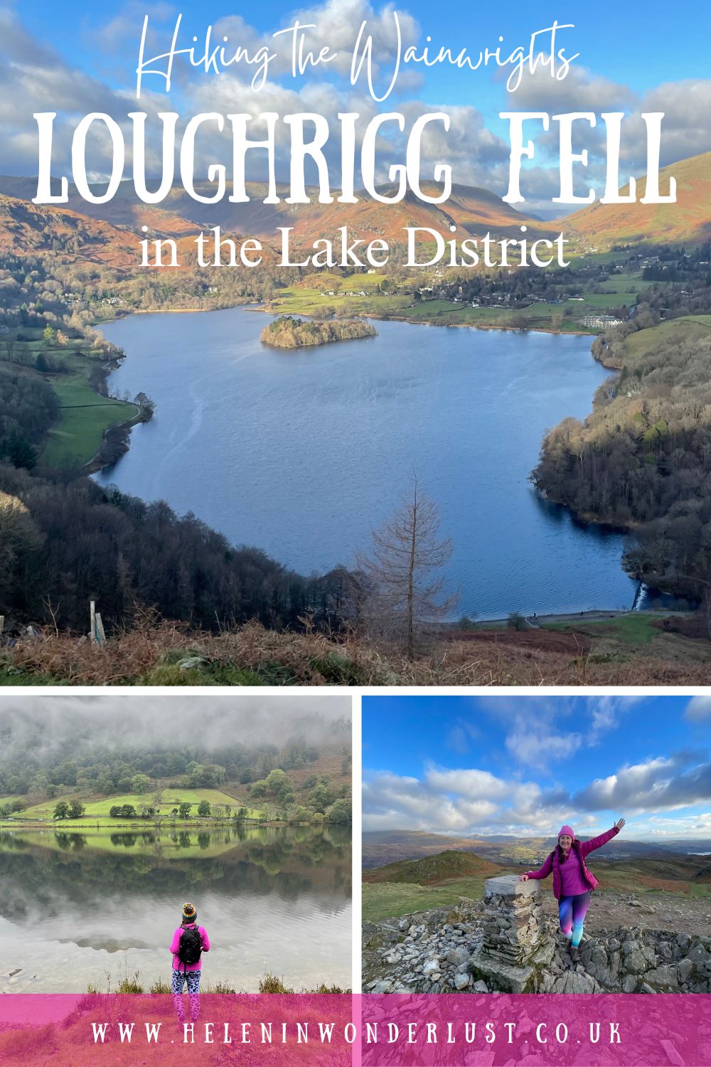
Hiking Loughrigg Fell in the Lake District
Last updated on September 15th, 2024 at 07:26 pm
I’ve just set myself a new challenge – to climb all of the Lake District Wainwrights.
If you don’t know already – the Wainwrights are a group of 214 fells (mountains and hills) in the UK Lake District that feature in Alfred Wainwright’s best-selling guidebooks – The Pictorial Guides to the Lakeland Fells. Climbing them is known as Wainwright ‘bagging’.
I’ve climbed a few Wainwrights before, including England’s highest mountain, Sca Fell (back in 1996 on my Duke of Edinburgh Silver Award) and Fleetwith Pike, but it was only in the last year or so that I became aware that they were called Wainwrights and that bagging them was a ‘thing’.
The aim is to see or touch the trig (usually a stone column) point. Once you’ve done that – you’ve ‘bagged’ it.
Two of my goals for 2024 are to improve my mental and physical health, and I love walking and being in the mountains, so this seems like a great way to do both!
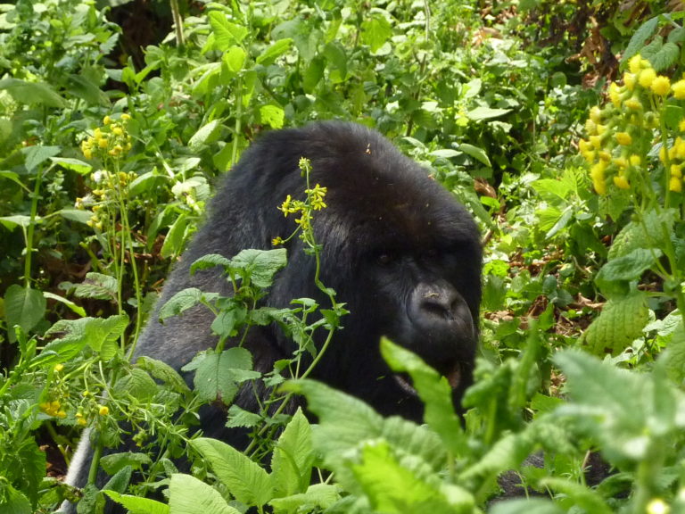
I’m not new to hiking. I’ve climbed plenty of mountains including Snowdon in Wales, Kilimanjaro in Tanzania (twice) and Nyiragongo in the DRC and I’m planning to hike Mount Kenya soon, but climbing all 214 of the Wainwrights is still a daunting prospect!
Especially as I’ll probably have to do a lot of them solo and I have very few map reading skills these days (it’s been a long time since that DofE). I do have a relatively good sense of direction – I’m more of a follow your instincts and hope for the best kind of gal – but that won’t always cut it in the mountains, so I will have to brush up on my map reading skills, and maybe take a navigation course!
I’m not setting a time limit to the challenge, I’ll just work through them as and when I can between trips to Africa. It might take me a year or two if I’m really motivated. It might take me five or ten years. Who knows? Who cares? It’s more about enjoying the process rather than ticking them off as quickly as possible.
Please Note: Some of the links in this post are affiliate links, which will earn me a small commission at no extra cost to you. Affiliate sales help with the running costs of this site, so thank you for your support!
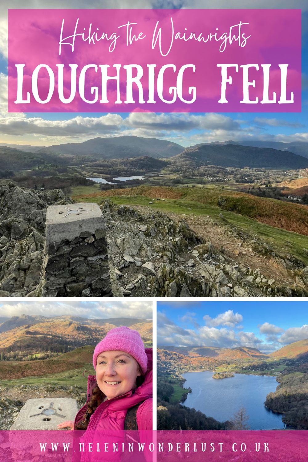
Loughrigg Fell – Wainwright 1/214
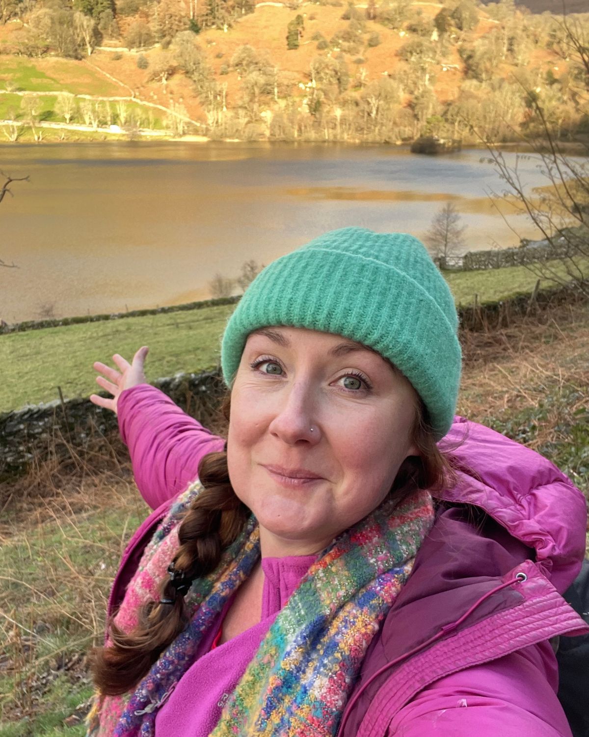
The first Wainwright on my (new) list, was Loughrigg Fell.
It’s one of the smaller Wainwrights and I chose this one because I’d read it was of moderate difficulty, relatively easy to navigate and has amazing views, so it ticked all the boxes for my first solo Wainwright bagging attempt.
- Wainwright: Loughrigg Fell (1/214)
- Region: Central Fells
- Elevation: 335m
- Hike Time: 2.5 Hours
- Difficulty: Moderate
- Month/Year: December 2023
- Weather: Cold and breezy, but sunny
- Parking: Pelter Bridge Car Park, Ambleside, LA22 9LW (see tariffs at the bottom of the page)
Start Point
You can start the walk up Loughrigg Fell from Ambleside or Grasmere if you want a longer walk, however, as I was a day visitor and short on time, I decided to park at the Pelter Bridge car park, near to Rydal Water (on the Ambleside side). Just be aware that this car park is quite small, so the earlier you get there, the better.
There is also some parking at St Mary’s Church off the main road (on the other side to Pelter Bridge), but this was full when I got there.
From here, there are various ways up to the top, but I chose to do a circular walk, starting with Rydal Water & Rydal Caves, going along Loughrigg Terrace, up the stairs to the trig. And then the plan was to go back down via Fox Ghyll…
You can also park at the White Moss Car Park on the other side of Rydal Water, on the Grasmere side. If you want to go that way, check out this post which will give you directions from there.
Section 1 – Rydal Caves & Loughrigg Terrace
And so it begins…
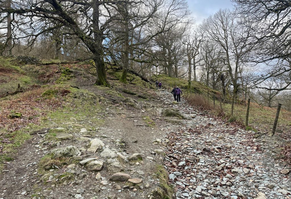
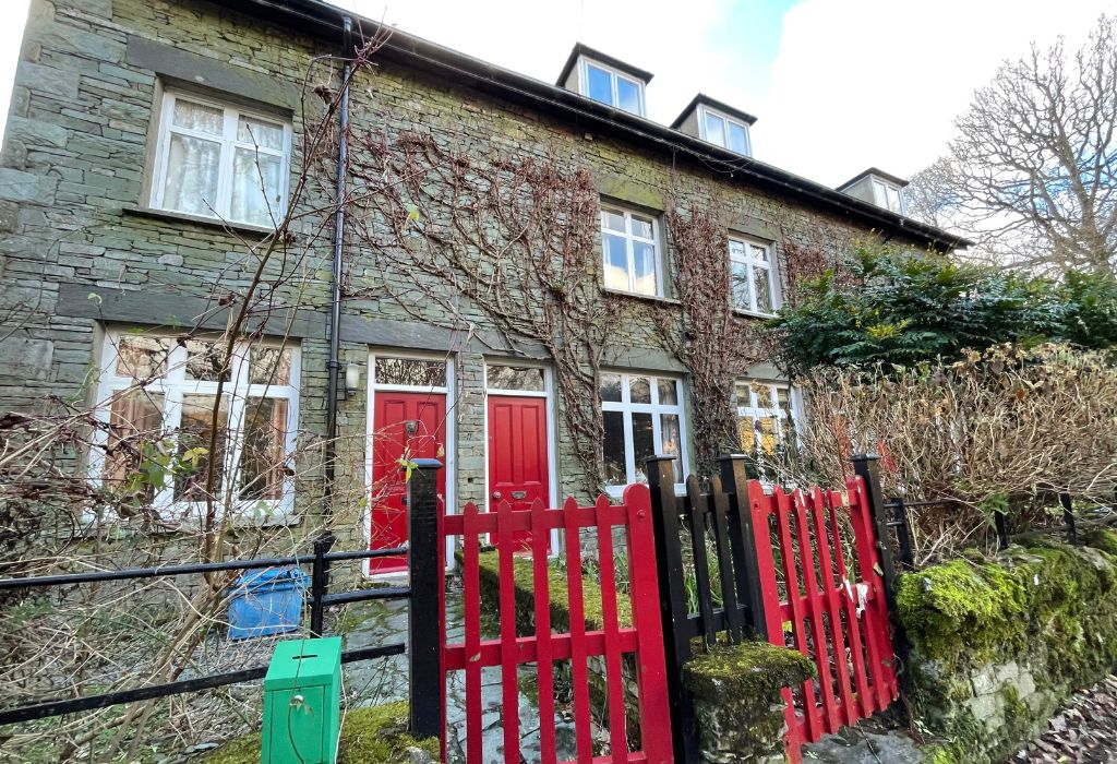
From the Pelter Bridge Car Park carpark, take a left and follow the lane up the hill. You’ll come to some cottages on the left . You’ll pass two sets of cottages before you reach a fork in the path. The one to the right leads down to Rydal Water (this is a nice easy walk along the lakeshore), but you want the one to the left that goes uphill towards Loughrigg Terrace.
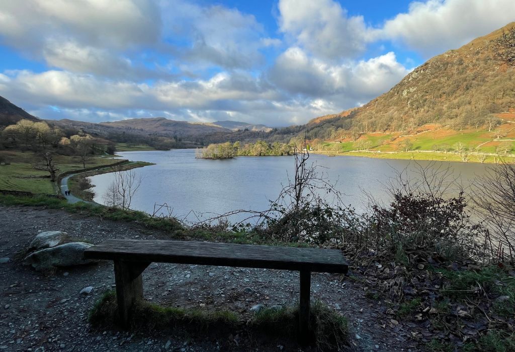
You’ll come to a bench, which is a nice place to stop and take a few pictures. After that, the path gets a bit rockier.
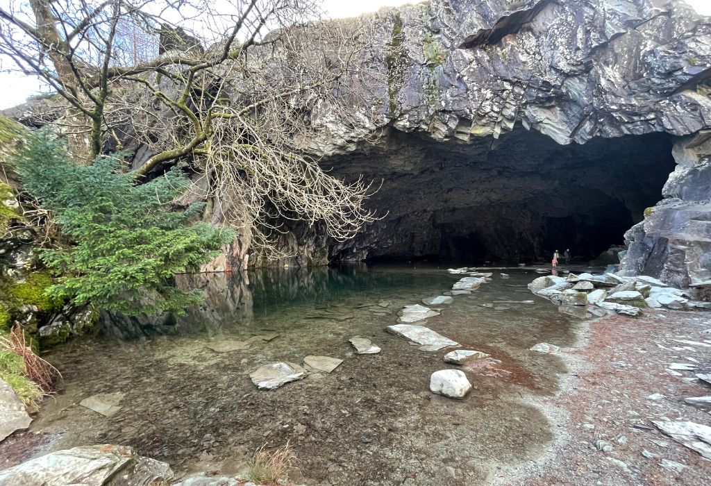
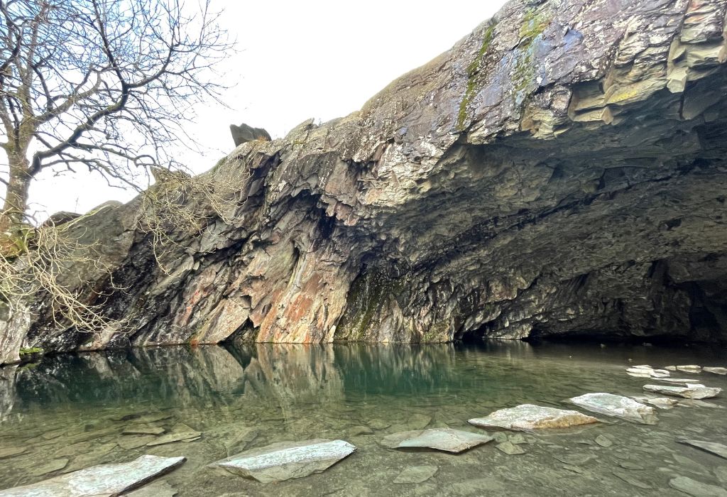
Continue along the path and on your left you’ll see Rydal Caves. The first cave is pretty, but this isn’t very accessible. So keep walking along the path (which turns to the left) and you’ll come across a bigger cave.
You can access this cave using the stepping stones and the view from inside to outside is pretty cool! And so are the echoes! It was here that I realised that I’d a) forgotten my camera (I only had my phone), b) brought my tripod (don’t you just love carrying useless excess weight on a hike) and c) brought 2 hats and 2 down jackets (I was wearing one and there was one in my bag).
In my defence, my bag looked full so I assumed it was my camera in there, but it turned out to be the jacket and hats that I’d packed the night before and forgotten about. My camera, was in my car, where I’d left it. I think I was a bit nervous when I first arrived at the car park and got a bit flustered.
Coming out of the cave, turn left (or if you didn’t go in and were just looking at the cave, continue right) and keep following the path upwards. Rydal Water will be on your right and the path is very distinctive, so you can’t really get lost.
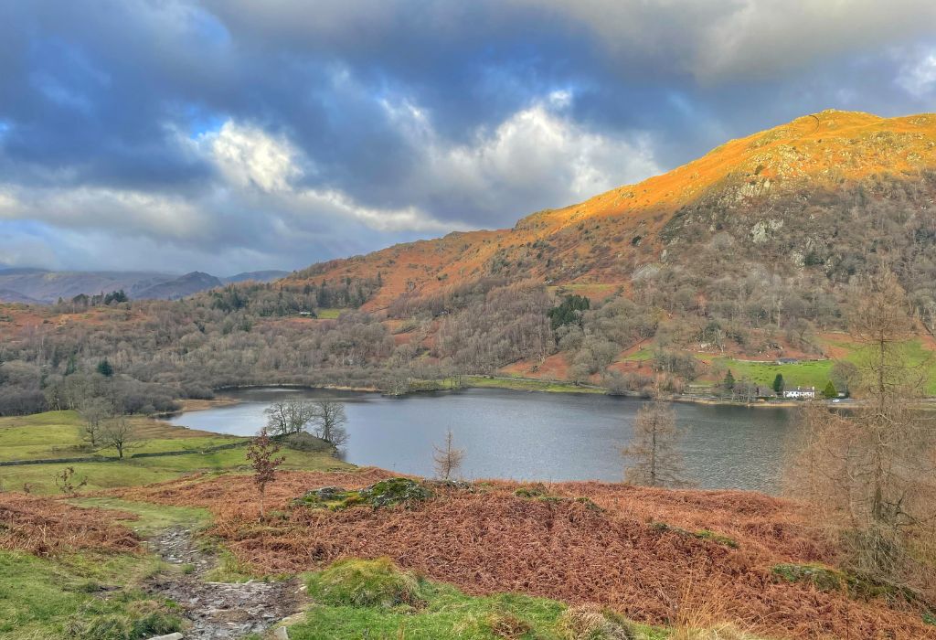
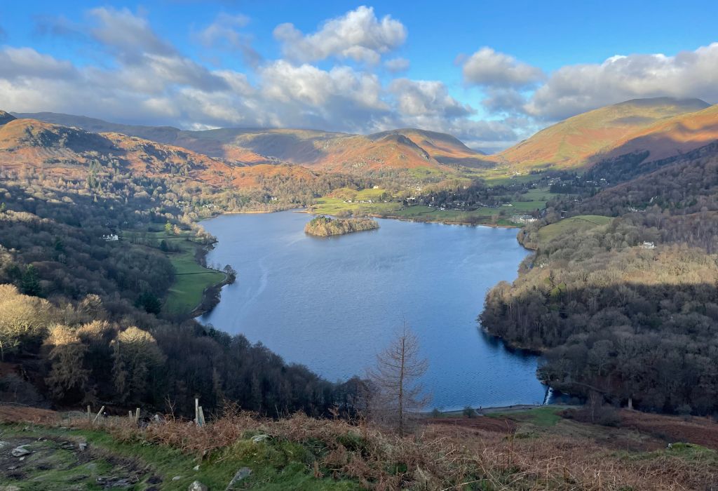
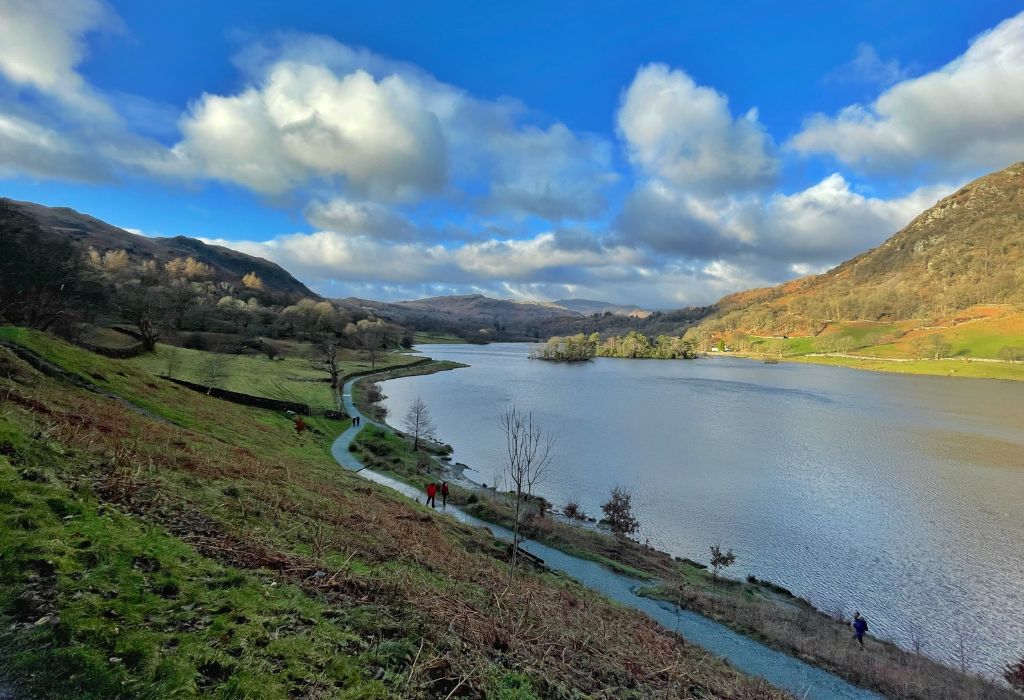
As you keep going, the path will go to the left and become Loughrigg Terrace. This isn’t marked, but you’ll know by the incredible views across Rydal Water and over to Grasmere.
William Wordsworth wrote of this view “the loveliest spot that man hath ever found”.
At one point, the path will fork with one going uphill a little and the other staying flat. You can take either as they both lead to the same place.
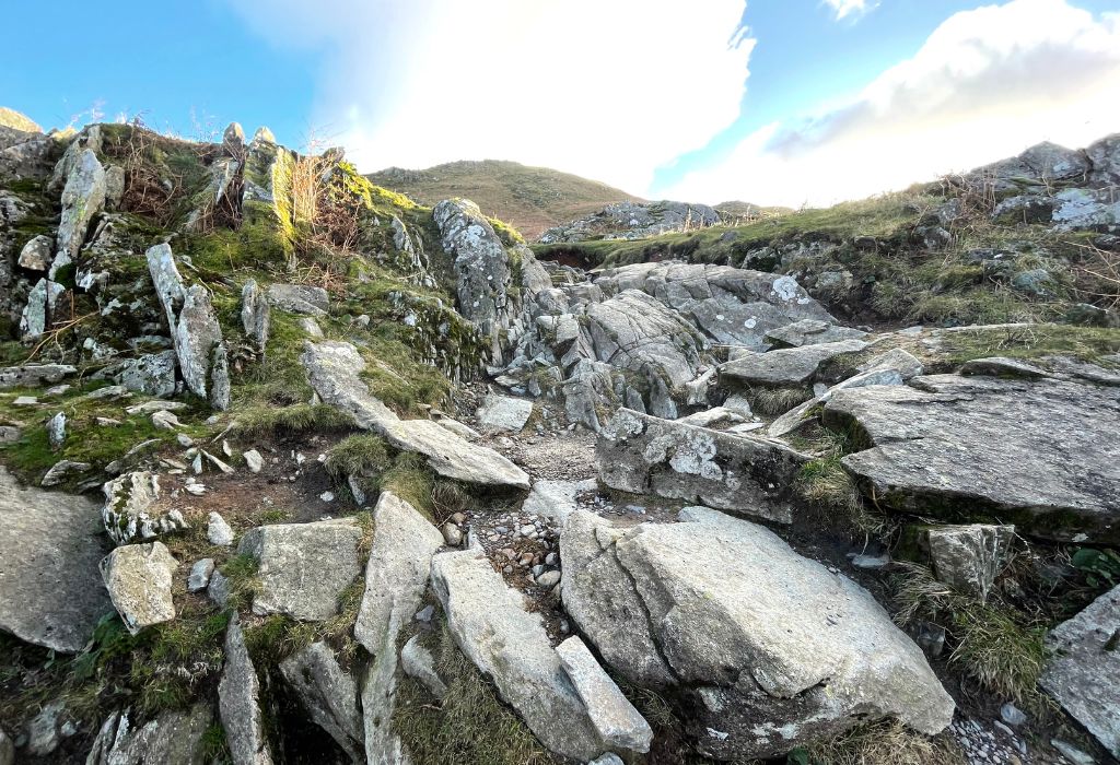
Keep following the path around to the left and you’ll see a bridge at the end of Rydal Water (you’re not going that far) and then you’ll come across a stone staircase on your left.
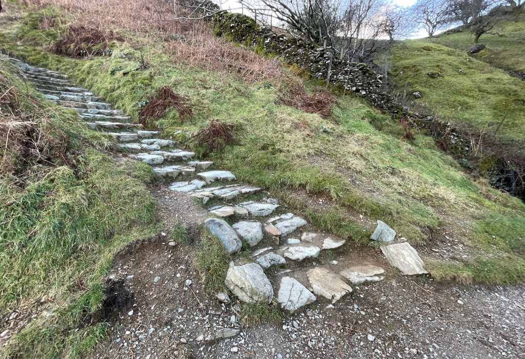
Section 2 – The Ascent
Take a sharp left up the stairs. They’re pretty steep, so expect a bit of a leg burner. You may want poles if you have dicky knees. But take your time (and lots of pictures) as the views are incredible from up here!
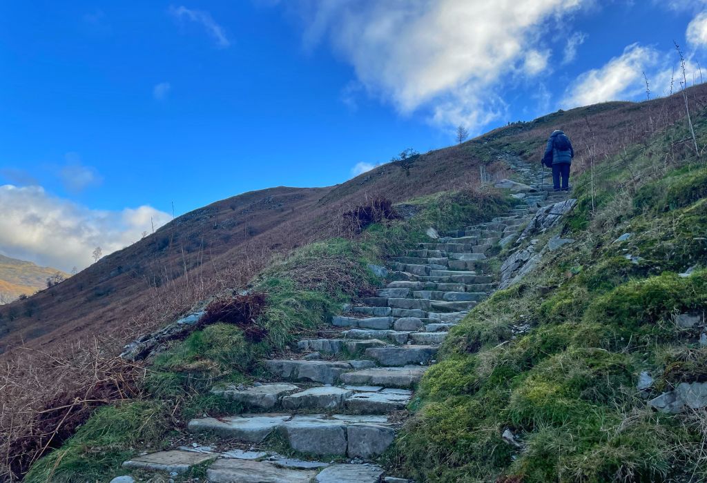
Even when the stairs end, the path is pretty obvious, so you won’t get lost. There is a little bit of scrambling involved towards the end, but nothing too extreme. Just keep heading up in the same direction and soon the trig point will come into view!!
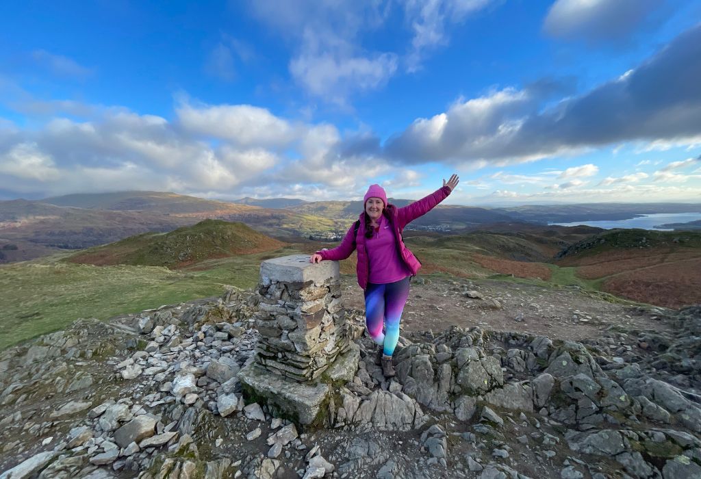
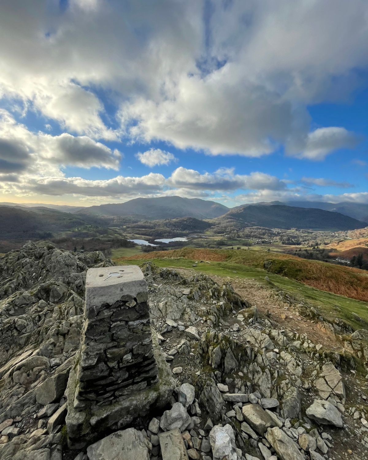
Section 3 – Loughrigg Fell Trig Point
From car park to trig, the walk took me 1 hour and 25 minutes walking at a moderate pace, with photo stops. I could have taken my time a bit more, but it was December, I started late and I wasn’t sure how long the walk was going to take me, so I probably rushed a bit more than I needed to.
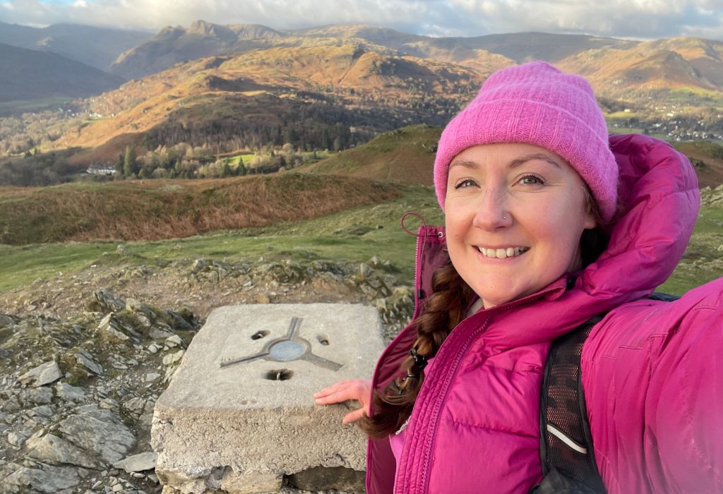
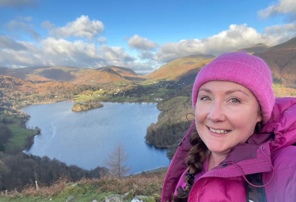
I was so happy to reach the top of Loughrigg Fell. Not only had I bagged my first Wainwright, but I’d done it solo. I’m not gonna lie, I was a little proud of myself.
And yes, I have technically climbed Wainwright’s before, but I was always with other people and I didn’t really know that I was ‘bagging’ anything and don’t think I went near the actual trigs – so I’m starting this challenge from scratch and will be re-doing them all.
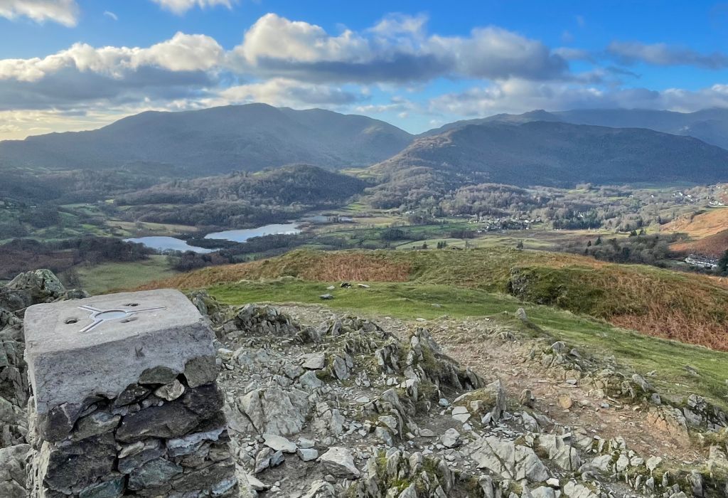
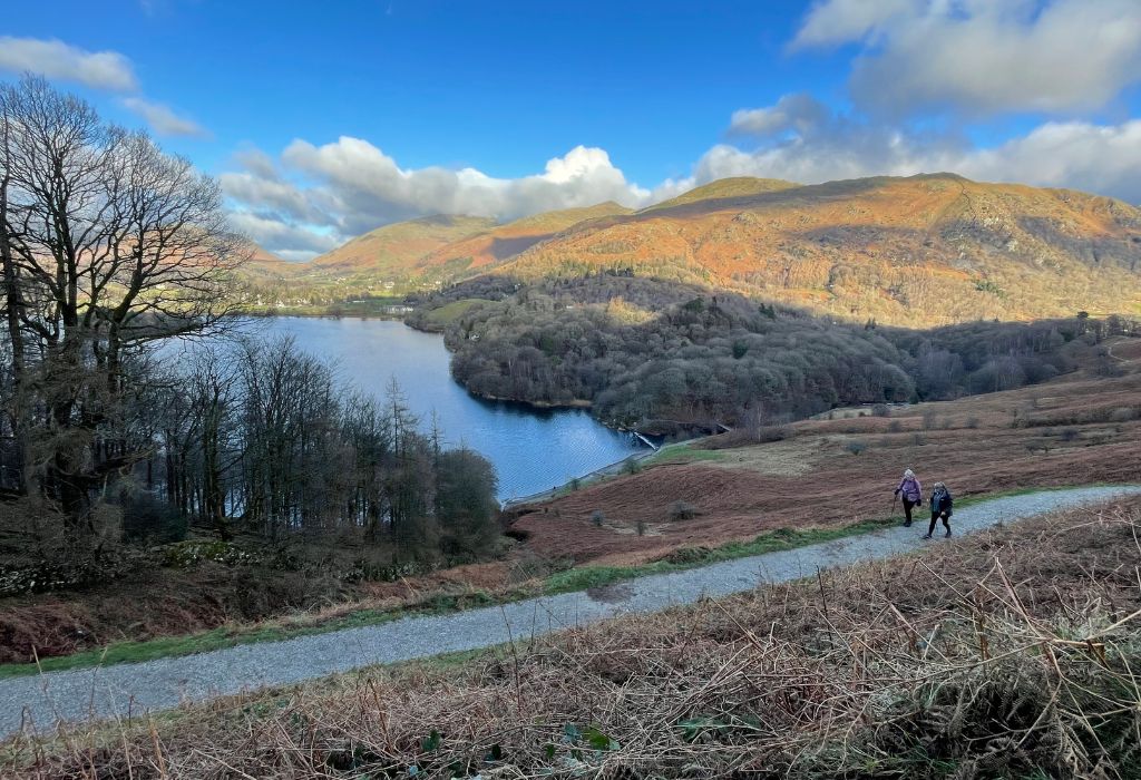
It was a clear day, so the view was incredible. I couldn’t see Rydal Water anymore as it was obscured by the hills, but I had more than enough in the way of views with Grasmere, Windermere and Elterwater. I just felt happy.
Hiking is such an amazing way to keep fit and improve your mental health plus it really gives you a real sense of achievement. And, aside from parking and petrol it’s free to do.
Another girl reached the top a minute or so after me, so we exchanged hellos and took a couple of pictures of each other before she wandered off. Next a big school group arrived and I took pictures of them. It was really nice! I love the sense of camaraderie you get when hiking in the Lakes. Everyone says hello.
Photos done, I found a sheltered spot on the other, less windy side and had my tuna butties and a cup of tea overlooking Elterwater.
Section 4 – The Descent
So this is where I got a little confused. It looked to me like there were a few different ways to go and I couldn’t make out a distinct path down (other than the way I’d come and I didn’t want to backtrack). Had I been with other people, I probably would have explored a bit. But I wasn’t, so I didn’t.
Some people were going down the way I’d come up and others seemed to go different ways – but no-one seemed to be going in the direction I thought I was supposed to go.
I had wanted to see Loughrigg Tarn (the lake) and I asked another hiker where it was and how long it would take to get there. He said “It will take about 20 minutes to get down there.”
Worried about being on my own and running out of daylight (my phone battery was dying and I didn’t have a head torch or map), I wanted to get back to the car as quickly as possible.
If it was 20 minutes down, it would likely take longer up, so I decided to skip it. It was only later that I realised he meant 20 minutes down to the actual lake. I didn’t even want to go right to the lake (on a warmer day I would have wanted to swim in it), I just wanted to see it from above, so if I’d just walked a few metres extra, I would have been able to see it and probably found the path I’d originally wanted to take.
A rookie mistake. Oh well, at least I’ll know for next time! I’ll just have to climb it again.
I then asked the man the ‘best’ way back to Pelter Bridge car park. He said “I’m not sure, but I’m going that way in a bit.” He pointed down the hill towards Rydal Water (which was hidden but I knew it was in that general direction). There wasn’t really a ‘path’ as such, but as the crow flies, it was a more direct route back towards Rydal Caves and the car park.
So off I went, going down from the trig to the left into a sort of grassy valley. A few minutes into my walk, realising I was completely alone, without a proper path to follow, I started to worry. I wasn’t freaking out, I knew I was heading in the right direction, but I was starting to worry that I might get stuck and thought maybe I should have gone back the way I came, on a proper path. So I turned around.
Just as I started to go back up, I saw the man walking towards me, ‘You ok?” he asked.
Erm… “I wasn’t sure where I was going, so I was going to turn round. But if you’re going that way, can I follow you?”
“Yes of course.” So off we walked together, chatting along the way. I learned his name was Tony and he was a retired teacher from Leeds. Just having another person there made me feel so much better. I guess (hope) the confidence to trust my instincts will come with time and practice.
The walk down was a bit steep and boggy, with both of us doing a few little slides, but the walk did bring us down to the path I’d started on, right near to Rydal Caves. Here we went our separate ways (thanks Tony).
I turned right, back towards Ambleside as he went left towards Grasmere. Once I got to the big cave (the one you can walk in), I followed the path down, then around to the right.
Keep walking, you’ll come to the edge of Rydal Water (the bench will be on your left this time) and then as you keep walking the cottages will be on your right. A couple of minutes later, you’ll be back at the car park.
If you wanted to make the Loughrigg Fell walk longer (which is what I’ll do next time), you can follow this route down from the top. Whilst it doesn’t start from Pelter Bridge, it does go past that way, so you’ll end up in the right place anyway.
If you have more time, perhaps stay over and explore some of the other cool places in the Lake District. There’s so much to see and do, you could spend years here and still not see it all.
Tips for Hiking Loughrigg Fell
- Park at either the Pelter Bridge Car Park (LA22 9LW) if you want to do this walk or White Moss Car Park (LA22 9SE) if you want to approach from the opposite direction.
- At Pelter Bridge, parking is £4 for up to 2 hours, £6.50 for up to 4 hours, £8.50 for up to 24 hours and £30 weekly. Cash and card is usually accepted. You can also pay on an app.
- When I was there, it kept spitting the coins, so I paid on card.
- Download the OS Maps before you get there. I had no signal when I arrived!
- Arrive early to get a good parking spot.
- Go during the week if you can, as there will be fewer people up there. It’s always busiest during weekends (especially bank holiday weekends) and the school holidays.
- Wear sturdy walking boots or shoes.
- If you have bad knees, think about bringing walking poles as it is pretty steep in points.
- Wear comfortable, layer-able clothes – you may want a fleece/down jacket as it can be cold and windy at the top. And don’t forget a rain jacket – this is the UK, after all.
- But also bring/wear sunscreen.The sun can be strong.
- Bring enough water and some food/snacks for the trip.
- Maybe even bring a flask of something hot to drink whilst you’re at the top.
- Take a powerbank and your phone wire in case you take a million pictures like me.
- If you want to swim in Loughrigg Tarn, bring your swimsuit, a towel/robe, and some water shoes.
- Bring your camera/phone/tripod, as you’ll want to capture the amazing views.
Other Lake District posts you might enjoy…
- Fleetwith Pike & the Buttermere Infinity Pool
- Wild Camping in the Lake District – A Beginner’s Guide
- 24 Beautiful Places to Visit in the Lake District
- Glamping in the Lake District – 18 Amazing Places to Stay
Enjoy the gorgeous views on your walk up Loughrigg Fell.
Pin This Post For Later